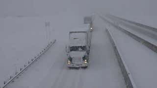
- A low pressure system will bring rain and snow to the Four Corners.
- Enough moisture may make it into S. California to keep fire concerns at bay.
- The northern tier will warm up midweek.
The week ahead will feature a robust storm system that will slowly travel from the Southwest to the Southeast while the northern tier returns to its warm winter.
1. Rounds of Southwest Rain and Snow
A change to the weather pattern is taking shape in the western U.S. and it will, finally, lead to some rain and snow for parts of California and the Four Corners region.
Both regions remain in the midst of a long-term, high-end drought.
More than half of the West, here defined as every state west of and including the Rockies states, is in an extreme drought. More than 22% of the West is in exceptional drought – the worst category.
But precipitation is on the way at least once in the upcoming week and possibly twice.
The jet stream is forecast to take a deep dip across the Southwest by Tuesday or Wednesday, which should help funnel Pacific moisture northeastward toward the Four Corners region.

Rain and Snow Outlook
Rain and snow will be generally light, but any moisture is a welcome sight after such a dry stretch. Some higher snowfall totals are possible in the Colorado Rockies.
Even better, another plume of moisture may drift southward across the West late in the week and into next weekend, allowing for another round of rain and snow.
2. Strong Wind Event in Southern California
The same drooping jet stream mentioned above will cause some problems in Southern California Tuesday into Wednesday.
A low pressure system will develop over northwestern Mexico or southern California during that time. It, combined with a dome of higher pressure to the north and west, will cause strong winds to drain from the Great Basin southwestward through the mountains and canyons of Southern California.
Wind gusts during this event could be strong enough to cause damage, but fire weather concerns are slightly lowered due to an increase in moisture brought by the low pressure system.

Wind Forecast
3. Mild Winter Continues in the Northern Tier
Continuing the warm winter, temperatures are expected to climb once again toward the middle of the week.
Highs are expected to be 10-25 degrees above average from the northern Rockies to the Plains and Midwest.
Highs of 40s and 50s are expected Wednesday in the Plains, and the Great Lakes will see highs above freezing either Wednesday or Thursday.

Midweek Highs
Even lows will rebound into the 20s for much of the northern and central Plains, the Midwest and the mid-Atlantic.
(MORE: Weekly Planner)
4. Southern Rain (and Snow?) Late Week
In the latter half of the week, the low pressure system from the Southwest is expected to kick across the Rockies and then the South.
Widespread rain showers are likely from Texas and Oklahoma to the Carolinas by Friday.
Some computer guidance is suggesting that the northern edge of this low pressure system could wrangle up enough cold air to produce some snow. This may happen somewhere from the Central Plains to the southern and central Appalachians.
This forecast will change over the next few days so stay tuned.

The Weather Company’s primary journalistic mission is to report on breaking weather news, the environment and the importance of science to our lives. This story does not necessarily represent the position of our parent company, IBM.
"Here" - Google News
January 17, 2021 at 03:46AM
https://ift.tt/2LE9L90
Here are Four Things We're Watching in the Weather in the Upcoming Week | The Weather Channel - Articles from The Weather Channel | weather.com - The Weather Channel
"Here" - Google News
https://ift.tt/39D7kKR
Shoes Man Tutorial
Pos News Update
Meme Update
Korean Entertainment News
Japan News Update
:no_upscale()/cdn.vox-cdn.com/uploads/chorus_asset/file/25244079/4.png)
No comments:
Post a Comment